I'm going to be too busy over the summer to continue with these photos, so that's it for now, I'm afraid!
I have to say that I have been disappointed with the response to this blog. There have been only 2 comments left in the last 3 months and none at all in the last 2 months. This is in complete contrast with my Ashton under Lyne blog which receives a number of comments for almost every post.
There has been a steady trickle of visitors since the blog started 6 months ago, but many of those have arrived here after searching for things on search engines. I suspect that there are not many regular visitors. I thought the combination of randomish canal photos plus links to aerial views would have had some appeal.
I don't know yet whether I will carry on with this after the summer or just give it up as an idea that didn't catch on.
Saturday, 12 July 2008
Okay, that's it!
Friday, 11 July 2008
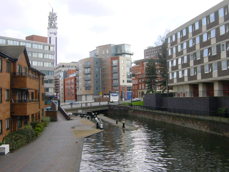
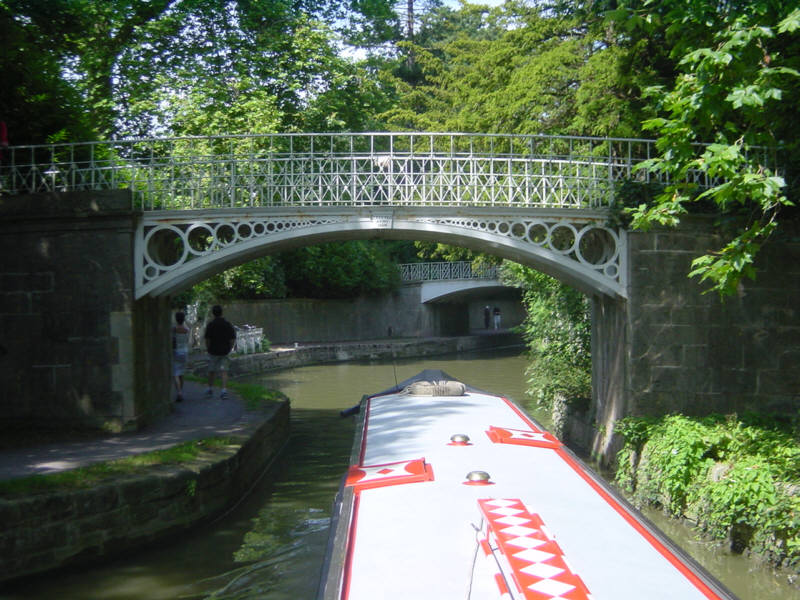
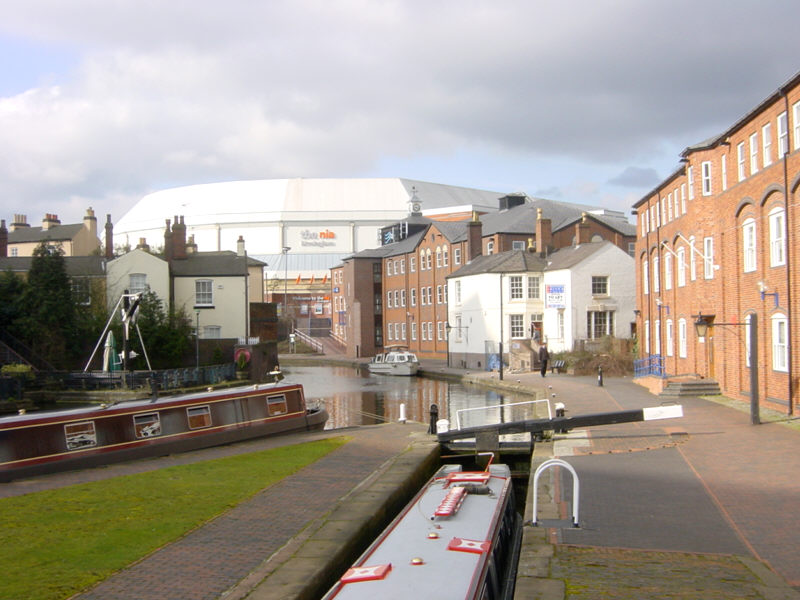
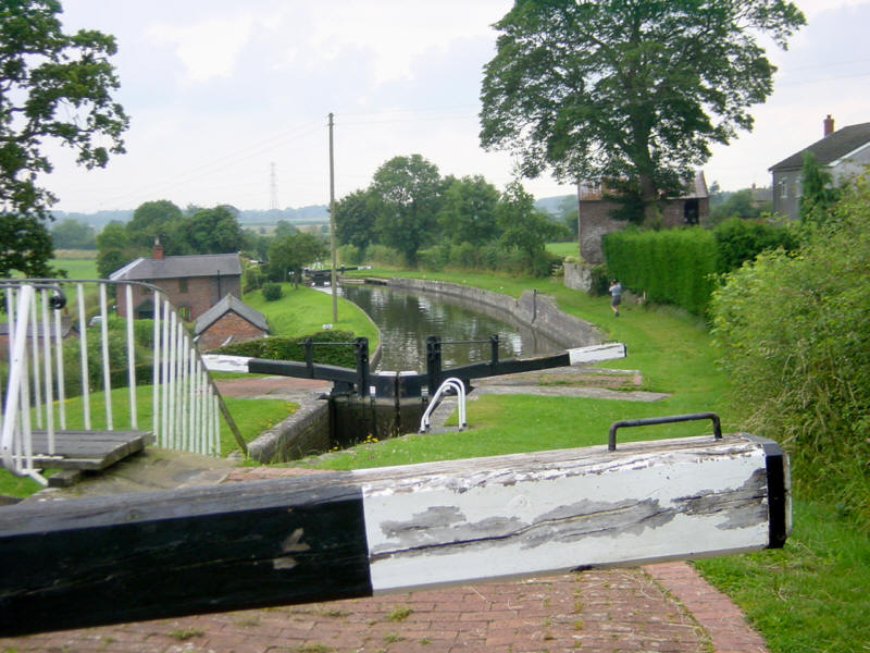
Birmingham
Another view from central Birmingham's vibrant canalscape - this time the 4th lock down the 13-lock Farmers Bridge flight, with the bridge carrying the A457 Summer Row from Birmingham to Smethwick.
See Google Aerial View of this location.
See LiveSearch Birds Eye View of this location.
Wednesday, 9 July 2008
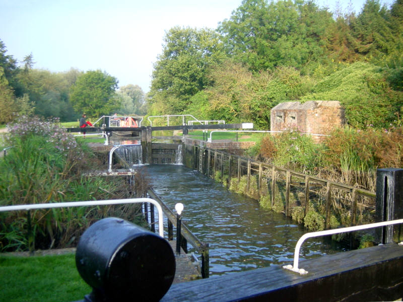
Aynho Weir Lock
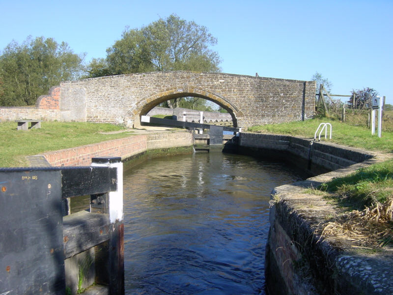
This is Aynho Weir Lock on the Southern Oxford Canal, south of Banbury. The lock is a curious shape, with narrow gates at each end, but with a chamber that widens out to around 20 feet, making it awkward for solo boaters with shorter boats, especially as there are no bollards to tie onto (or, at least, there weren't when the photo was taken).
The lock only has a fall of around 1 foot, but it feeds the 12 foot deep Somerton Lock, 3 miles downstream. So, the unusual shape is to allow extra water to be sent downstream each time the lock is used.The River Cherwell crosses the canal on a level just above Aynho Weir Lock, sometimes creating interesting currents.
See Google Aerial View of this location.
Monday, 7 July 2008
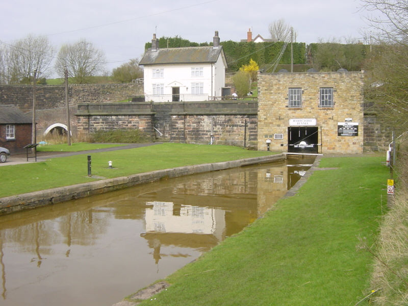
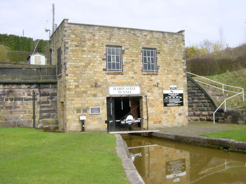
Harecastle
Another view of the southern portal of Harecastle Tunnel on the Trent and Mersey Canal in Staffordshire.
In the background on the left you can see the portal to Brindley's original 1777 tunnel, which is no longer navigable.
See Google Aerial View of this location.
See LiveSearch Birds Eye View of this location.
Saturday, 5 July 2008
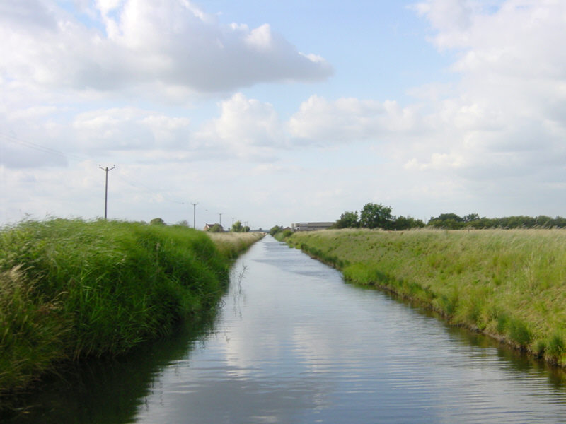
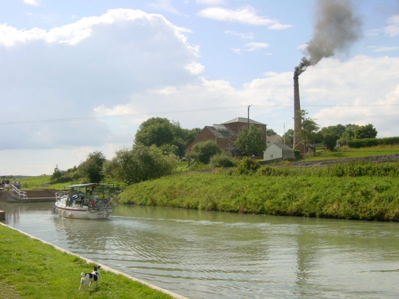
Witham Navigable Drains
A view along Newham Drain on the Witham Navigable Drains, near Boston in Lincolnshire.
The Witham Navigable Drains are a network of around 40 miles of channels of various widths, accessed by locking down from the River Witham at Anton's Gowt. The drains lead into Boston alongside Maud Foster's Windmill.
See Google Aerial View of this location.
Thursday, 3 July 2008
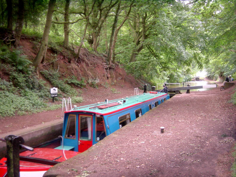
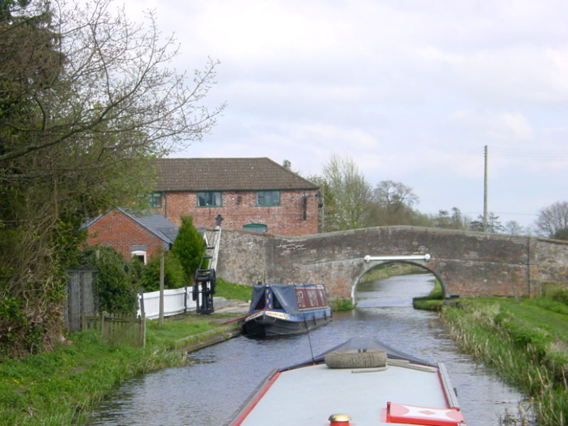
Tyrley Locks
Just a mile south of the bridge at Market Drayton is the flight of five locks at Tyrley. The strikingly red soil of the cutting indicates red sandstone underlying the area.
Tyrley Castle once stood on a site between here and Market Drayton, now occupied by Tyrley Castle Farm. Above the locks is Tyrley Wharf with its collection of 1840s red brick buildings.
See Google Aerial View of this location.
Tuesday, 1 July 2008
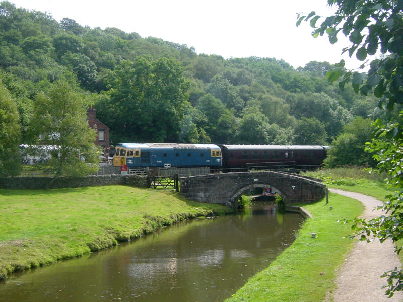
Consall Forge
Consall Forge is a surprisingly remote place on the Caldon Canal in Staffordshire. It is many miles from the nearest road, by means of a narrow track. It does, however, have a station on the North Staffordshire Railway (Churnet Valley Railway).
The Black Lion Inn, seem behind the railway, is a must for boaters stopping here overnight on their way to Froghall.
See Google Aerial View of this location.
Sunday, 29 June 2008
Netherton Tunnel
The southern end of Netherton Tunnel near Dudley. This view is approaching the tunnel from nearby Windmill End. The tunnel is 2768 metres long (1.72 miles). It was opened in 1858, is wide enough for two narrowboats to pass and has towpaths down both sides so that two-way traffic could operate back in the days when boats were horse drawn.
See Google Aerial View of this location.
See LiveSearch Birds Eye View of this location.
Friday, 27 June 2008
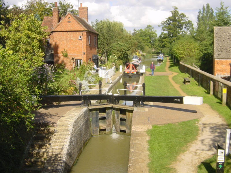
Garston Lock
Garston Lock, on the Kennet and Avon Canal near Theale, is another example of a Kennet turf-sided lock, although it was modified during restoration to improve safety.
The lock was built in the 1720s. A number of the locks on the Kennet navigation were originally of this sloping-sided design, since water consumption was less of a problem on a river than on a canal. Only two remain. (See also Monkey Marsh Lock.)
See Google Aerial View of this location.
Wednesday, 25 June 2008
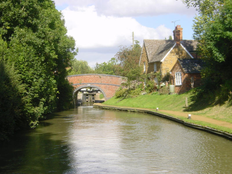
Cropredy
Another view of picturesque Cropredy on the South Oxford Canal, this time from below the bridge and lock.
See Google Aerial View of this location.
Monday, 23 June 2008
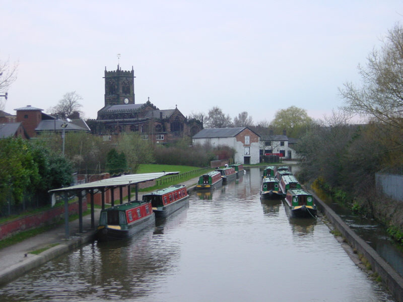
Middlewich
Middlewich is a busy location on the Trent and Mersey Canal. The Middlewich Branch from the Shropshire Union Canal arrives in the town from the west, so a visit to Middlewich forms part of many people's routes. There are two hire boat bases here and the town is a popular stop for boaters.
See Google Aerial View of this location.
Saturday, 21 June 2008
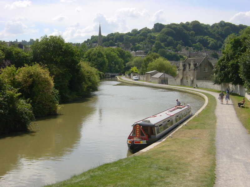
Bath
Just above the Widcombe flight of locks in Bath, the Kennet and Avon Canal passes through the middle of the Sydney Gardens. The gardens were Bath's first "park" and were visited frequently by Jane Austen.
They were created in 1795 and 15 years later, in 1810, the canal was constructed through the middle. Later still, in 1840, the Great Western Railway carved a parallel cutting through the gardens.
See Google Aerial View of this location.
See LiveSearch Birds Eye View of this location.
Friday, 20 June 2008
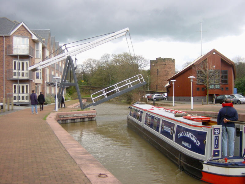
Froncysyllte
Froncysyllte is on the Llangollen Canal just on the south side of the famous Pontcysyllte Aqueduct. The canal passes through the edge of Froncysyllte village.
In the distance can be seen the lift bridge and footbridge just before the bend that takes the canal round to the aqueduct.
See Google Aerial View of this location.
Wednesday, 18 June 2008
Trent Lock
The River Trent at Trent Lock is a peaceful location on a sunny day, although the area can become exciting when the river is in flood.
This spot is a complicated waterway junction, with the River Trent leading upstream to the right towards Sawley and the Trent and Mersey Canal and ahead towards the weir marked by the red barrels. To the right of the weir, the white sign marks the entrance to the River Soar, leading to Leicester and the Grand Union Canal. To the left, in the foreground, the weir is bypassed by the Cranfleet Cut leading downstream towards Nottingham. Out of sight to the left is Trent Lock, which lets boats access the Erewash Canal.
See Google Aerial View of this location.
See LiveSearch Birds Eye View of this location.

Monday, 16 June 2008
Heartbreak Hill
Lock 65 seen from Lock 66 of the Trent and Mersey Canal just east of Wheelock in Cheshire. These locks form part of the lock flight known as "Heartbreak Hill".
Lock 66 is the bottom lock (or rather, pair of locks) of the flight. The "Heartbreak Hill" locks were doubled to relieve congestion on the canal, although some of the duplicate locks are no longer used and a few are filled in.
See Google Aerial View of this location.

Saturday, 14 June 2008
Foxton
The splendid staircase locks at Foxton, Leicestershire. The 10 locks, built in 1810, are in the form of two 5-rise staircases, raising the canal by 75 feet. This photo looks towards the upper 5 locks from alongside the lower 5. The paddle gear painted red releases water into side pounds to save water.
Between 1900 and 1911 boats could alternatively use the adjacent inclined plane boat lift, built in an attempt to compete with the railways, which lifted two boats together in one of its two counter-balanced caissons. Short-sightedly the lift was sold for scrap in 1928 but there are proposals to restore it.
This picture appears today to mark the Festival taking place there this weekend to celebrate the restoration of the upper canal arm and lower basin leading to the site of the inclined plane.
See Google Aerial View of this location.
Friday, 13 June 2008
Chester
The Dee Locks Branch of the Shropshire Union Canal at Chester provides a link between the canal system and the tidal River Dee. The sea lock is operated by British Waterways staff by prior booking.
See Google Aerial View of this location.
See LiveSearch Birds Eye View of this location.
Wednesday, 11 June 2008
Northwich
One of the two swing bridges that carry roads across the River Weaver at Northwich in Cheshire. Many of the buildings in Northwich resemble the tudor style. This is because the salt mining in the area causes as great deal of subsidence, so many of the buildings are of timber frame construction, with brick panels. The buildings have jacking points and their alignment can be adjusted to compensate for any ground movement, so that the buildings remain level.
Boats can reach the River Weaver from the parallel Trent and Mersey Canal by means of Anderton Lift.
See Google Aerial View of this location.
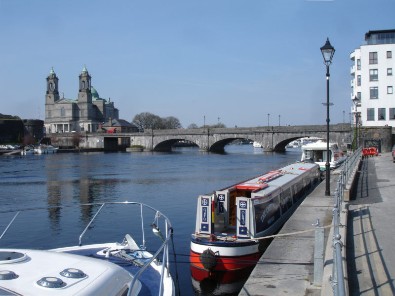
Sunday, 8 June 2008
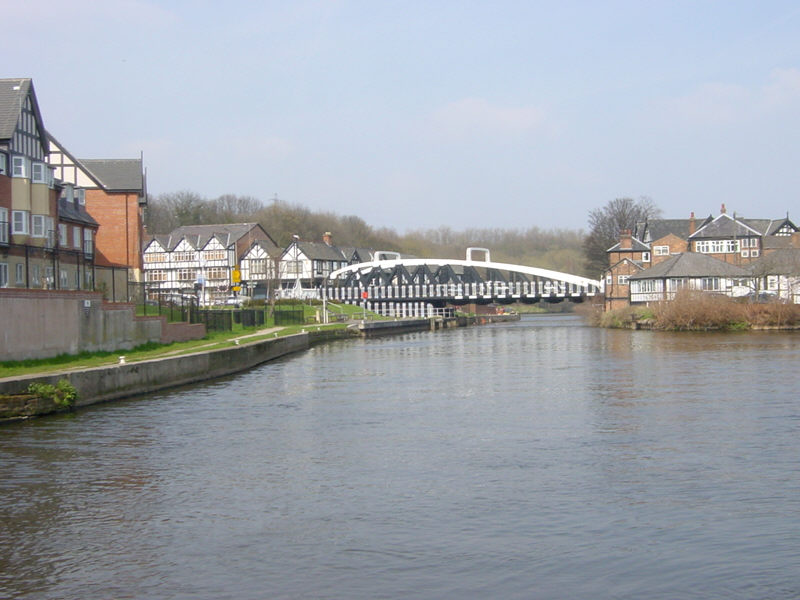
Athlone
Another hop across to Ireland shows us the River Shannon just below the bridge in Athlone. Out of shot to the left is a wide sweeping weir and Athlone Lock. A couple of miles north of Athlone is the southern end of the 15 mile long Lough Ree, through which the Shannon flows.
See Google Aerial View of this location. The image is only fuzzy and shows no close detail. However, the old lock cut that once bypassed Athlone can be clearly seen.
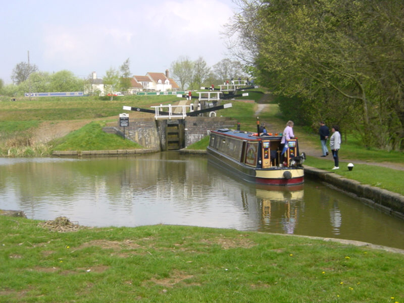
Thursday, 5 June 2008
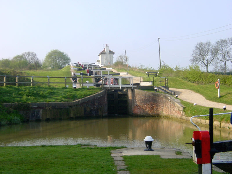
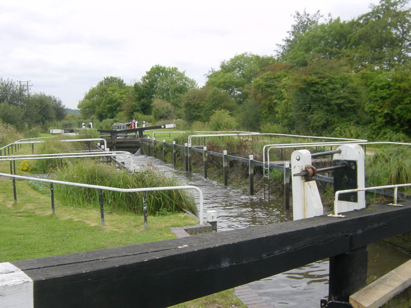
Watford
There are 7 locks at Watford on the Grand Union Canal's Leicester Branch, 4 of which form a staircase. These locks, not far from the bustling Watford Gap service area on the M1 motorway, create a substantial bottleneck on this busy canal link, and it is not unknown for boats to queue for more than an hour.
See Google Aerial View of this location.
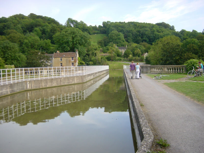
Tuesday, 3 June 2008
Avoncliffe
Avoncliffe Aqueduct carries the Kennet and Avon Canal across the River Avon one and a half miles west of Bradford-on-Avon. Just behind the camera, the canal narrows again to cross the railway.
See Google Aerial View of this location.
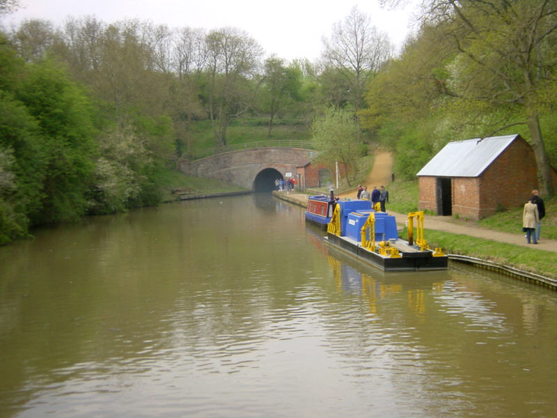
Sunday, 1 June 2008
Blisworth
Less than half a mile from yesterday's busy scene at Stoke Bruerne, the Grand Union Canal disappears through the wooded hillside into Blisworth Tunnel. At 2794 metres long, it is the 7th longest canal tunnel built in the UK and the 3rd longest currently navigable.
There are stories of boaters seeing another tunnel that is lit up, branching off in the middle of Blisworth Tunnel. What is spooky is that these sightings seem to be at a point where the present tunnel crossed the original line, which collapsed with the loss of 14 lives. The original route had to be abandoned because of the unstable ground.
See Google Aerial View of this location.
Saturday, 31 May 2008
Stoke Bruerne
There is always a busy canalside scene at Stoke Bruerne in Northamptonshire. The Canal Museum and a cluster of pubs at the top of the flight of 7 locks makes the village a popular destination for visitors and a popular overnight mooring for boaters.
See Google Aerial View of this location.
Thursday, 29 May 2008
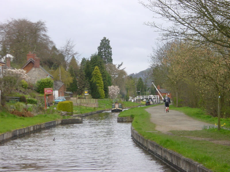
Cropredy
Cropredy Lock, in the picturesque village of Cropredy, on the Southern Oxford Canal about 4 miles north of Banbury.
The village (pronounced "Croperdy") is famous for its annual folk and rock music festival, Fairport's Cropredy Convention, which attracts around 20,000 people each year, including a good number of boaters.
See Google Aerial View of this location.
Monday, 26 May 2008
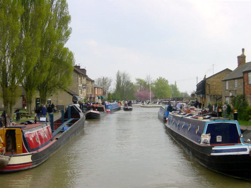
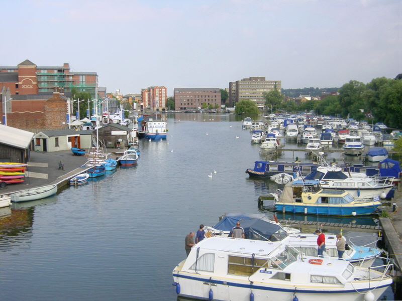
Birmingham
The top lock of the Farmers Bridge flight on the Birmingham and Fazeley Canal in Birmingham City Centre.
The canal here reaches the Birmingham Level of the BCN. In the background is the National Indoor Arena.
See Google Aerial View of this location.
See LiveSearch Birds Eye View of this location.
Saturday, 24 May 2008
Widcombe, Bath
A longish pound between locks on the Widcombe flight on the Kennet and Avon Canal in Bath.
See Google Aerial View of this location.
See LiveSearch Birds Eye View of this location.
Friday, 23 May 2008
Frankton Locks
Looking southwards from the staircase locks at Frankton, where the Montgomery Canal leaves the Llangollen Canal.
This section, along with the nearby infilled Weston Branch, had originally been intended to be part of the main line of the Ellesmere Canal leading to Shrewsbury.
See Google Aerial View of this location.
Wednesday, 21 May 2008
Vale Royal Locks
Looking across the locks at Vale Royal on the River Weaver in Cheshire. The larger lock (furthest from camera) was constructed to allow sea-going vessels to reach the salt mines alongside the river near Winsford.
The River Weaver is accessed from the Trent and Mersey Canal via the Anderton Lift.
The photo was taken before the wall below the nearer lock collapsed, making the lock too dangerous to use. The aerial image shows the wall collapse and also the long-disused third lock.
See Google Aerial View of this location.

Monday, 19 May 2008
Lymm
Lymm Bridge in the village of Lymm, Cheshire, just 5 miles east of Warrington. Lymm is a favourite stop for boaters on the Bridgewater Canal.
[Photo contributed by Richard Carpenter]
See Google Aerial View of this location.
Saturday, 17 May 2008
Monkey Marsh Lock
Monkey Marsh Lock is one of the two remaining "turf-sided" locks on the River Kennet section of the Kennet and Avon Canal.
Using timber and turf for construction, this was an early style of lock-building used on some river navigations. Because of the sloping sides, they use more water than conventional locks, but this is less important on a river. Modern metal posts have been added as a safety feature, to prevent boats from settling on the sloping sides as the lock empties.
Monkey Marsh Lock is near Thatcham Station and about 3 miles east of Newbury in Berkshire.
See Google Aerial View of this location.
Thursday, 15 May 2008
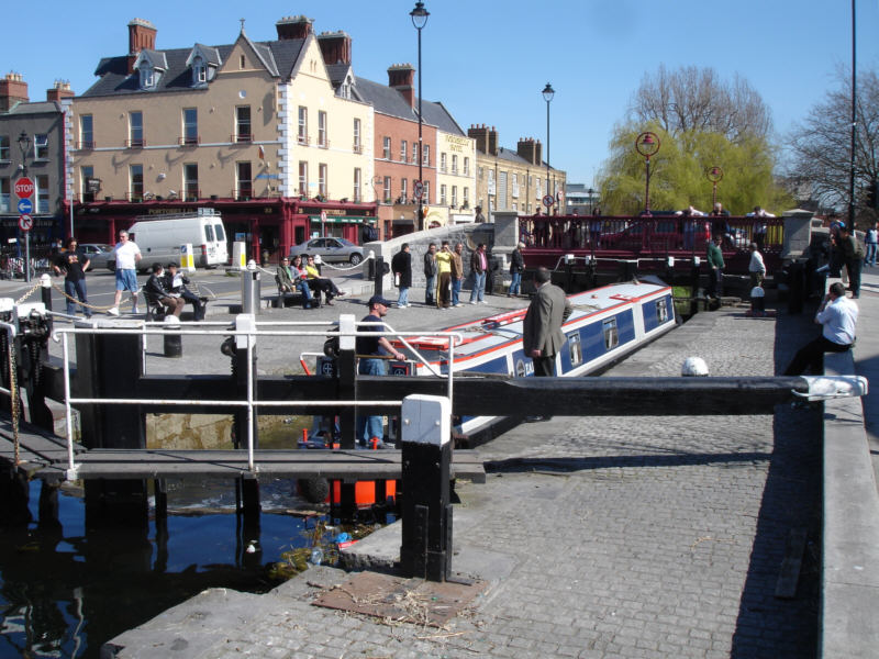
Dublin
Portabello Lock, the highest of seven locks on the "Circular Line" connecting the River Liffey with the main line of the Grand Canal, in Dublin, Ireland.
The crowds which gather to watch are not just because an English narrowboat is an unusual sight in Ireland, but also because any boat passing through these well cared-for locks is an unusual sight, as few boats venture down into Dublin.
See Google Aerial View of this location.
Tuesday, 13 May 2008
Tixall Wide
Tixall Wide is a favourite location for many boaters. The Staffordshire and Worcestershire Canal opens out unexpectedly around half a mile west of its junction with the Trent and Mersey Canal at Great Haywood. Also known as "The Broad Water", the wide was created to give the impression of a lake when viewed from the nearby (but now gone) Tixall Hall.
See Google Aerial View of this location.
Monday, 12 May 2008
Windmill End
Windmill End Junction is a crossroads where the Netherton Tunnel Branch meets the Dudley No 1 and No 2 Canals and the short Boshboil Branch. Netherton Tunnel, with its towpaths along both sides, is a short distance ahead, to the left of Cobb's Engine House.
See Google Aerial View of this location.
See LiveSearch Birds Eye View of this location.
Friday, 9 May 2008
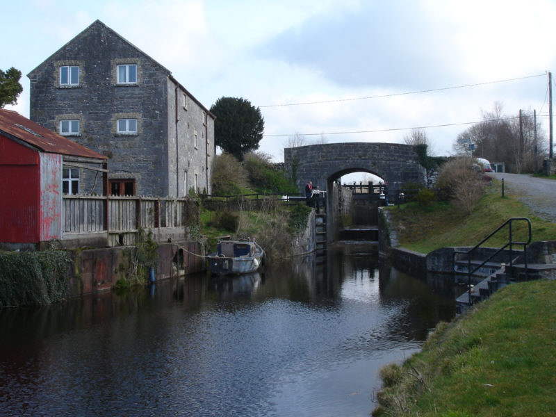
Carreghofa Revisited
Another visit to Carreghofa on the Montgomery Canal, where the canal descends through two locks. The photo shows the interesting style of ground paddle that is in use here. Unfortunately the paddle is on the offside, opposite to the balance beam, necessitating some running back and forth!
See Google Aerial View of this location.
Wednesday, 7 May 2008
Dundas Aqueduct
The mighty Dundas Aqueduct that carries the Kennet and Avon Canal across the River Avon near Limply Stoke, south-east of Bath. A Grade One listed building, it was the first canal structure to be scheduled as an Ancient Monument.
On the western side of the aqueduct is the junction with the Somersetshire Coal Canal. This ran some 18 miles to Paulton, with a branch to Radstock and Midsomer Norton. Only a 200 metre stretch of the canal is now open from the junction at Dundas and is used as moorings.
See Google Aerial View of this location.

Monday, 5 May 2008
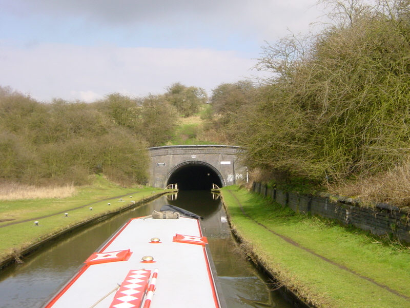
Harecastle
The southern portal of Harecastle Tunnel, on the Trent and Mersey Canal near Kidsgrove, Staffordshire. Built by Telford in 1827, this is the second of the two tunnels. The first is no longer navigable. In the 1950s, a fan house was built over the southern portal to extract engibe fumes from the tunnel, as there are no ventilation shafts.
The tunnel is said to be haunted by the Kidsgrove Boggart or "Kit Crewbucket".
See Google Aerial View of this location.
See LiveSearch Birds Eye View of this location.
Saturday, 3 May 2008
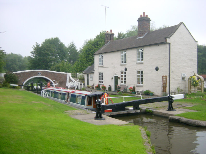
Crofton
Crofton Pumping Station, 6 miles from Marlborough, pumps water up six locks to the summit level of the Kennet and Avon Canal. The Pumping Station houses two Cornish steam-powered beam engines, one of which, built in 1812, is claimed to be "the oldest working beam engine in the world still in its original engine house and capable of actually doing the job for which it was installed". [read more]
The pump took water from natural springs and later a small lake that was created to the south of the canal - see aerial photo.
See Google Aerial View of this location.
The building is open daily in the summer months and is on steam on certain days. [see dates]
Friday, 2 May 2008
Anton's Gowt
An evening scene on the River Witham at Anton's Gowt in Lincolnshire. This is about two miles north-west of Boston. To the right, between the moorings, is Anton's Gowt Lock, which goes down onto Frith Bank Drain on the extensive Witham Navigable Drains.
See Google Aerial View of this location.
Wednesday, 30 April 2008
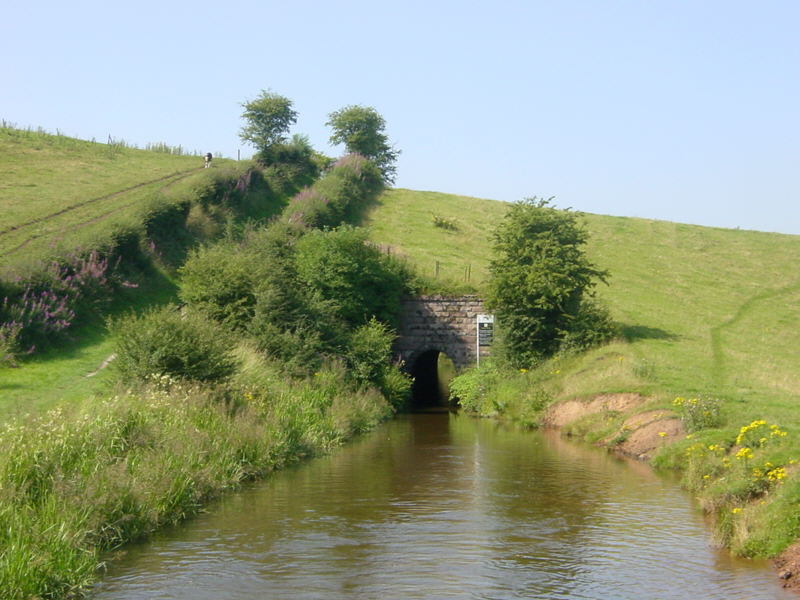
Leek Tunnel
Leek Tunnel on the Caldon Canal in Staffordshire. This short 130 yard tunnel is on the Leek Arm of the Caldon Canal. Part of the tunnel had to be re-lined and it was closed for a long time. An industrial estate has been built over the final half mile of the branch into Leek.
See Google Aerial View of this location.
Monday, 28 April 2008
Mill at Marple

Goyt Mill stands next to Eccles Bridge on the Macclesfield Canal at Hawk Green, near Marple.
See Google Aerial View of this location.
Saturday, 26 April 2008
Wigan
Lock 80 of the Leeds and Liverpool Canal at Wigan. The canal climbs 23 locks at Wigan, making a tiring day for boaters. The area on the right was known as Bambers Quay. It would be interesting to hear if anyone knows the function of the new tower by the next lock. One passer-by thought it might be concealing a phone mast, but they don't usually go to that much trouble!
See Google Aerial View of this location.
Friday, 25 April 2008
Knighton Wharf
Knighton Wharf on the Shropshire Union Canal. The wharf was used by Cadbury's from 1911 to 1961. Chocolate "crumb" was produced in the adjoining factory, using local milk, and was taken by narrow boat to Bourneville in Birmingham.
Cadbury built the crumb factory at Knighton because it was found to be more efficient to take the cocoa to the milk than transport the milk over a long distance.
See Google Aerial View of this location.

Thursday, 24 April 2008
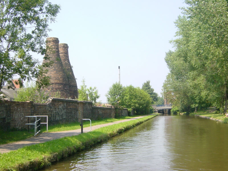
Etruria
Alongside the Trent and Mersey Canal, between the second and third locks up the Stoke flight, stand these pottery kilns.
The two bottle kilns were built in 1887 for Thomas Twyford's Cliff Vale Pottery, Etruria. The listed kilns have been preserved while most of the disused pottery site has been cleared. Only the two kilns and the buildings fronting Shelton New Road survive.
See Google Aerial View of this location.
See LiveSearch Birds Eye View of this location.
Monday, 21 April 2008
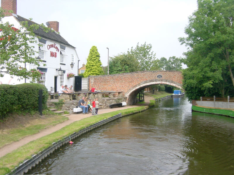
Penkridge
The Cross Keys Inn is alongside the Staffordshire and Worcestershire Canal next to Filance Bridge in Penkridge.
See Google Aerial View of this location.
Saturday, 19 April 2008
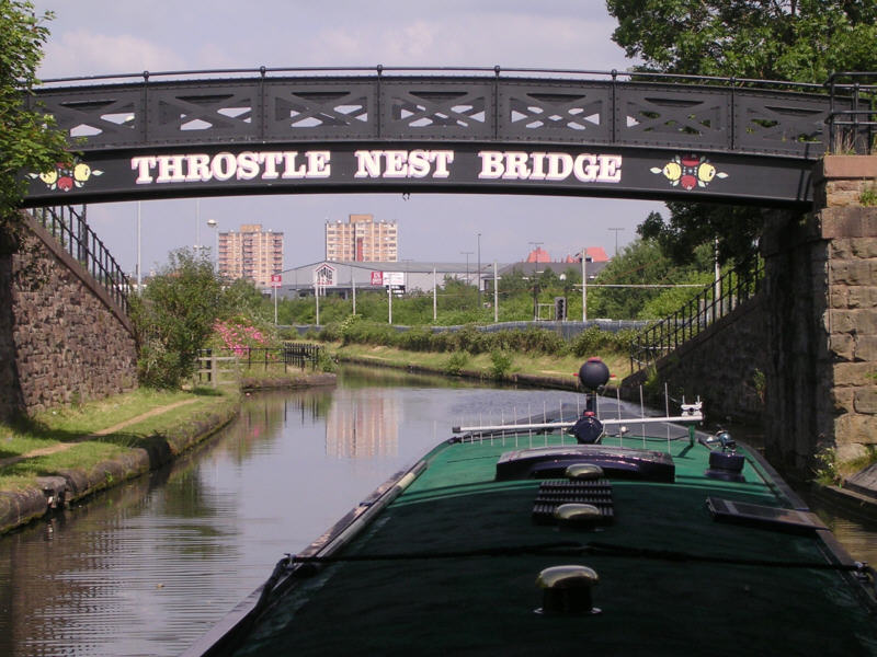
Throstle Nest
Throstle Nest Turnover Bridge on the Bridgewater Canal at Old Trafford, half a mile east of Manchester United's football stadium. The towpath changes sides here. Throstle Nest Lock was situated a short distance to the north on the River Irwell, but was demolished with the construction of the Manchester Ship Canal.
[Photo contributed by Richard Carpenter]
See Google Aerial View of this location.
Friday, 18 April 2008
Tixall
Tixall Lock on the Staffordshire and Worcestershire Canal, opened in 1772. This is the first lock encountered after leaving the Trent and Mersey Canal. Half a mile south from nearby Tixall Bridge, good walking is to be had around Milford Common at the northern end of Cannock Chase.
See Google Aerial View of this location.
Wednesday, 16 April 2008
Lincoln
Looking across Brayford Pool at the eastern end of Foss Dyke in Lincoln. In the far left corner of the pool, boats exit via the Glory Hole to the Witham Navigation.
See Google Aerial View of this location.
See LiveSearch Birds Eye View of this location.
Monday, 14 April 2008
Merry Hill
The Waterfront at Merry Hill, on the Dudley No 1 Canal near Brierley Hill. The Merry Hill Shopping Centre is behind the camera.
See Google Aerial View of this location.
See LiveSearch Birds Eye View of this location.
Sunday, 13 April 2008
Maesbury Marsh
Bridge 79 on the Montgomery Canal at Maesbury Marsh, near Oswestry. A crane still stands on the small wharf. Adjoining the bridge is the Navigation Inn and Warehouse Restaurant. The canal here was built as the Llanymynech Branch of the Ellesmere Canal. Closed following a breach near Frankton in 1936, this section was re-opened in 2003.
See Google Aerial View of this location.
Friday, 11 April 2008
Belmont Double Lock
Belmont Double Lock on the Grand Canal in Ireland. The lock keeper awaits the approaching boat. Notice the practice often found in Ireland of entering the bottom chamber of a staircase with both chambers empty and the middle gates open.
The Grand Canal runs 82 miles from Dublin to the River Shannon with the Barrow Line linking it to the River Barrow. Five of the 43 locks on the Grand Canal are Double locks (two-rise staircase locks), along with two of the nine locks on the Barrow Line.
Wednesday, 9 April 2008
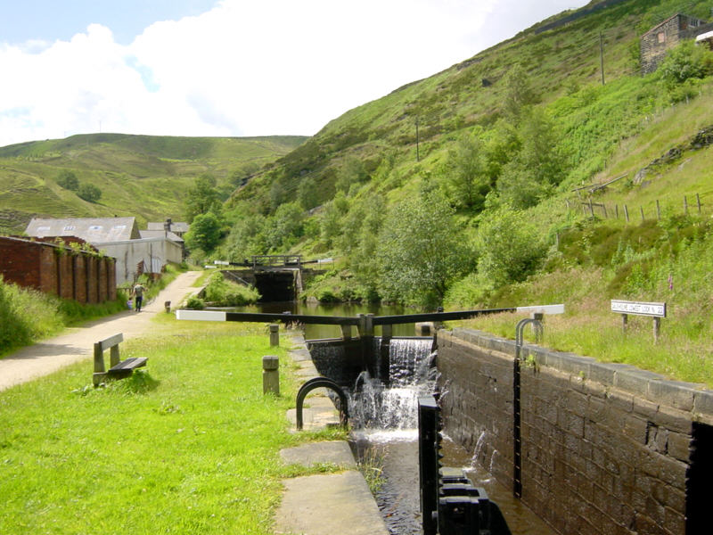
Gauxholme
The Rochdale Canal climbing out of Todmorden through the steep-sided Calder Valley at Gauxholme. Lock 22 is in the foreground.
See Google Aerial View of this location.