
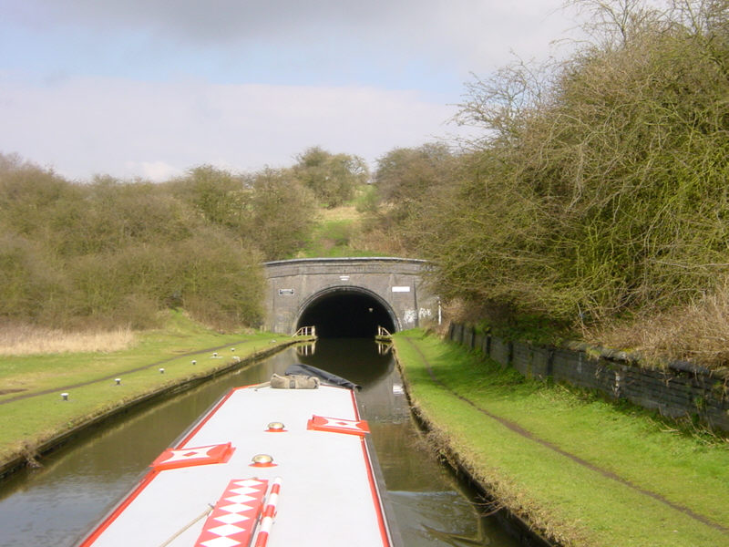
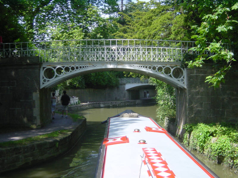
The southern end of Netherton Tunnel near Dudley. This view is approaching the tunnel from nearby Windmill End. The tunnel is 2768 metres long (1.72 miles). It was opened in 1858, is wide enough for two narrowboats to pass and has towpaths down both sides so that two-way traffic could operate back in the days when boats were horse drawn.
See Google Aerial View of this location.
See LiveSearch Birds Eye View of this location.
Sunday, 29 June 2008
Netherton Tunnel
Friday, 27 June 2008
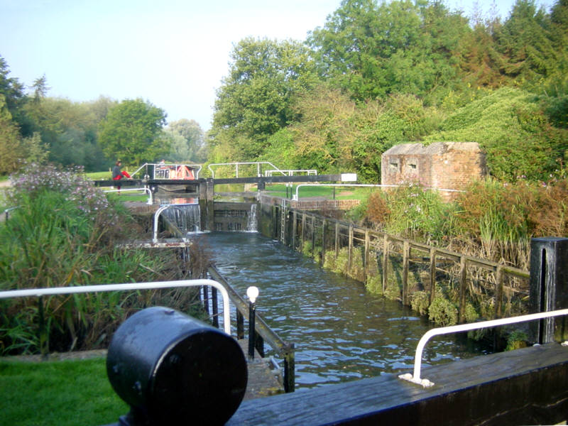
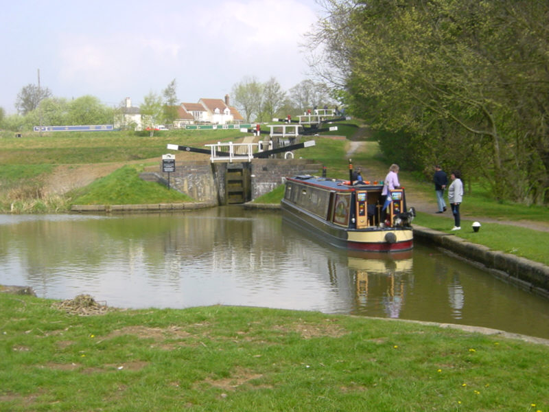
Garston Lock
Garston Lock, on the Kennet and Avon Canal near Theale, is another example of a Kennet turf-sided lock, although it was modified during restoration to improve safety.
The lock was built in the 1720s. A number of the locks on the Kennet navigation were originally of this sloping-sided design, since water consumption was less of a problem on a river than on a canal. Only two remain. (See also Monkey Marsh Lock.)
See Google Aerial View of this location.
Wednesday, 25 June 2008
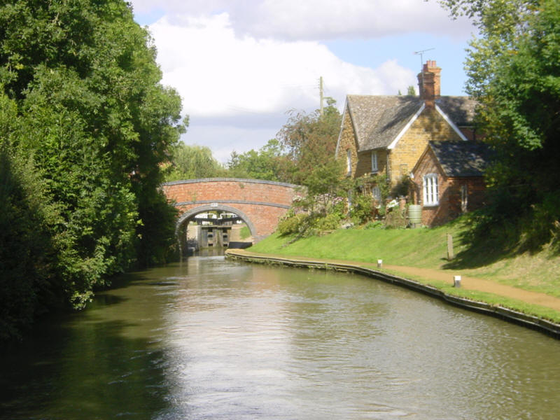
Cropredy
Another view of picturesque Cropredy on the South Oxford Canal, this time from below the bridge and lock.
See Google Aerial View of this location.
Monday, 23 June 2008
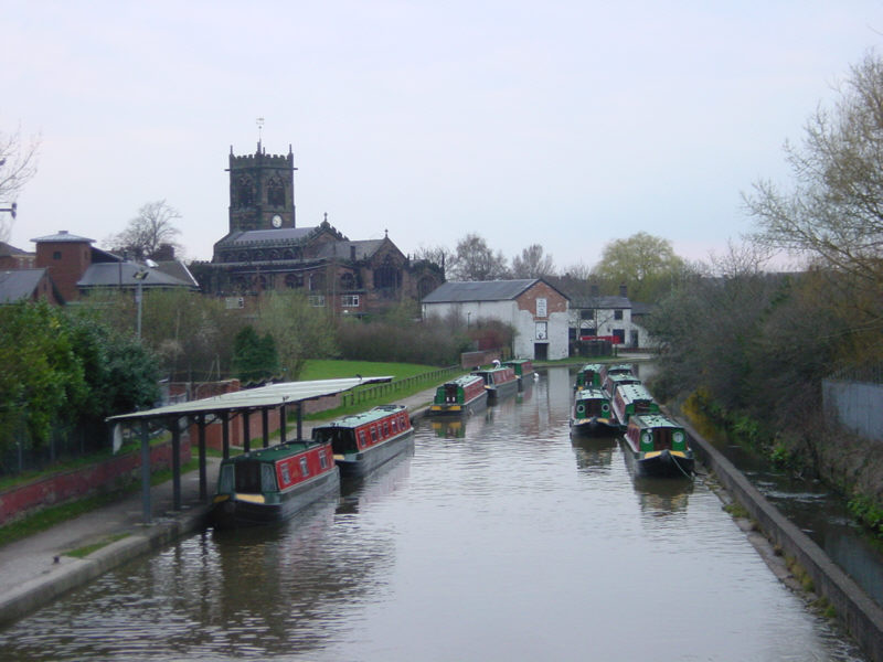
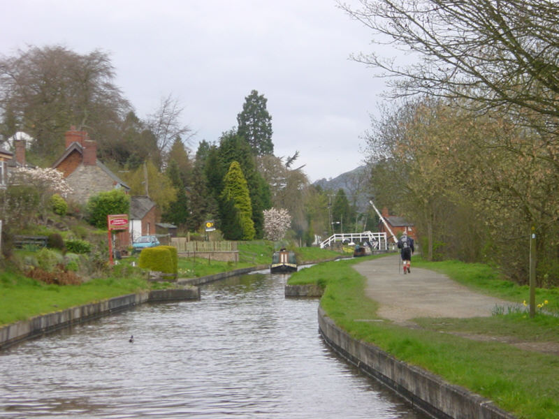
Middlewich
Middlewich is a busy location on the Trent and Mersey Canal. The Middlewich Branch from the Shropshire Union Canal arrives in the town from the west, so a visit to Middlewich forms part of many people's routes. There are two hire boat bases here and the town is a popular stop for boaters.
See Google Aerial View of this location.
Saturday, 21 June 2008
Bath
Just above the Widcombe flight of locks in Bath, the Kennet and Avon Canal passes through the middle of the Sydney Gardens. The gardens were Bath's first "park" and were visited frequently by Jane Austen.
They were created in 1795 and 15 years later, in 1810, the canal was constructed through the middle. Later still, in 1840, the Great Western Railway carved a parallel cutting through the gardens.
See Google Aerial View of this location.
See LiveSearch Birds Eye View of this location.
Friday, 20 June 2008
Froncysyllte
Froncysyllte is on the Llangollen Canal just on the south side of the famous Pontcysyllte Aqueduct. The canal passes through the edge of Froncysyllte village.
In the distance can be seen the lift bridge and footbridge just before the bend that takes the canal round to the aqueduct.
See Google Aerial View of this location.
Wednesday, 18 June 2008
Trent Lock
The River Trent at Trent Lock is a peaceful location on a sunny day, although the area can become exciting when the river is in flood.
This spot is a complicated waterway junction, with the River Trent leading upstream to the right towards Sawley and the Trent and Mersey Canal and ahead towards the weir marked by the red barrels. To the right of the weir, the white sign marks the entrance to the River Soar, leading to Leicester and the Grand Union Canal. To the left, in the foreground, the weir is bypassed by the Cranfleet Cut leading downstream towards Nottingham. Out of sight to the left is Trent Lock, which lets boats access the Erewash Canal.
See Google Aerial View of this location.
See LiveSearch Birds Eye View of this location.

Monday, 16 June 2008
Heartbreak Hill
Lock 65 seen from Lock 66 of the Trent and Mersey Canal just east of Wheelock in Cheshire. These locks form part of the lock flight known as "Heartbreak Hill".
Lock 66 is the bottom lock (or rather, pair of locks) of the flight. The "Heartbreak Hill" locks were doubled to relieve congestion on the canal, although some of the duplicate locks are no longer used and a few are filled in.
See Google Aerial View of this location.

Saturday, 14 June 2008
Foxton
The splendid staircase locks at Foxton, Leicestershire. The 10 locks, built in 1810, are in the form of two 5-rise staircases, raising the canal by 75 feet. This photo looks towards the upper 5 locks from alongside the lower 5. The paddle gear painted red releases water into side pounds to save water.
Between 1900 and 1911 boats could alternatively use the adjacent inclined plane boat lift, built in an attempt to compete with the railways, which lifted two boats together in one of its two counter-balanced caissons. Short-sightedly the lift was sold for scrap in 1928 but there are proposals to restore it.
This picture appears today to mark the Festival taking place there this weekend to celebrate the restoration of the upper canal arm and lower basin leading to the site of the inclined plane.
See Google Aerial View of this location.
Friday, 13 June 2008
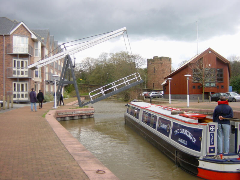
Chester
The Dee Locks Branch of the Shropshire Union Canal at Chester provides a link between the canal system and the tidal River Dee. The sea lock is operated by British Waterways staff by prior booking.
See Google Aerial View of this location.
See LiveSearch Birds Eye View of this location.
Wednesday, 11 June 2008
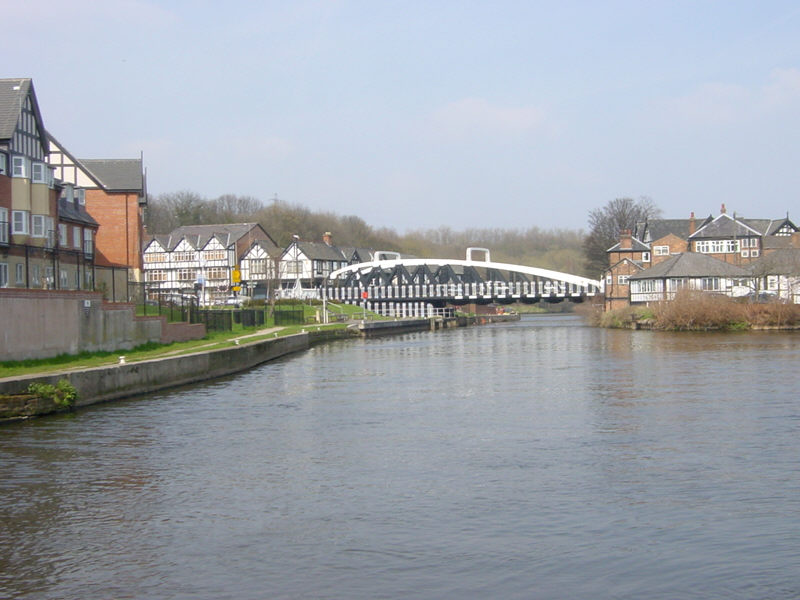
Northwich
One of the two swing bridges that carry roads across the River Weaver at Northwich in Cheshire. Many of the buildings in Northwich resemble the tudor style. This is because the salt mining in the area causes as great deal of subsidence, so many of the buildings are of timber frame construction, with brick panels. The buildings have jacking points and their alignment can be adjusted to compensate for any ground movement, so that the buildings remain level.
Boats can reach the River Weaver from the parallel Trent and Mersey Canal by means of Anderton Lift.
See Google Aerial View of this location.
Sunday, 8 June 2008
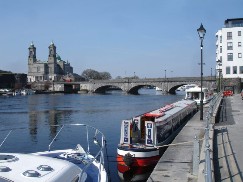
Athlone
Another hop across to Ireland shows us the River Shannon just below the bridge in Athlone. Out of shot to the left is a wide sweeping weir and Athlone Lock. A couple of miles north of Athlone is the southern end of the 15 mile long Lough Ree, through which the Shannon flows.
See Google Aerial View of this location. The image is only fuzzy and shows no close detail. However, the old lock cut that once bypassed Athlone can be clearly seen.
Thursday, 5 June 2008
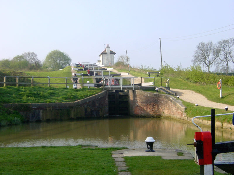
Watford
There are 7 locks at Watford on the Grand Union Canal's Leicester Branch, 4 of which form a staircase. These locks, not far from the bustling Watford Gap service area on the M1 motorway, create a substantial bottleneck on this busy canal link, and it is not unknown for boats to queue for more than an hour.
See Google Aerial View of this location.
Tuesday, 3 June 2008
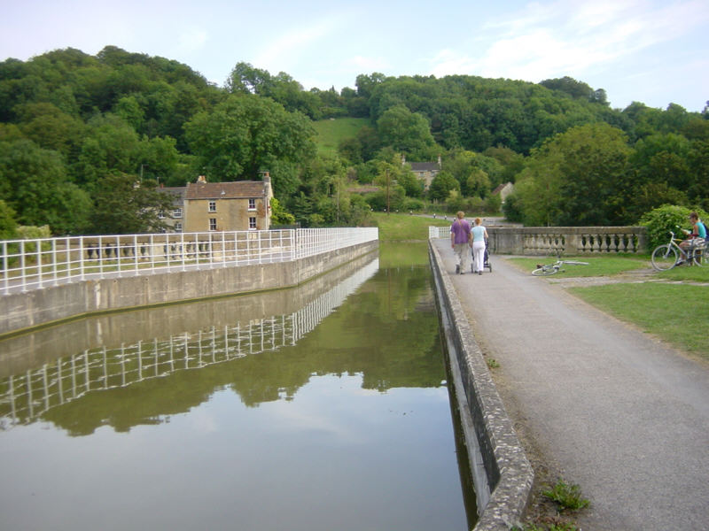
Avoncliffe
Avoncliffe Aqueduct carries the Kennet and Avon Canal across the River Avon one and a half miles west of Bradford-on-Avon. Just behind the camera, the canal narrows again to cross the railway.
See Google Aerial View of this location.
Sunday, 1 June 2008
Blisworth
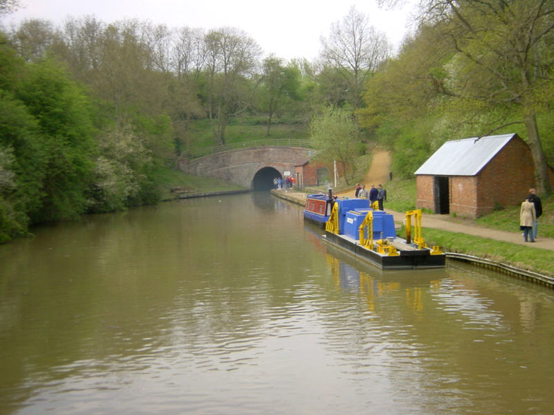
Less than half a mile from yesterday's busy scene at Stoke Bruerne, the Grand Union Canal disappears through the wooded hillside into Blisworth Tunnel. At 2794 metres long, it is the 7th longest canal tunnel built in the UK and the 3rd longest currently navigable.
There are stories of boaters seeing another tunnel that is lit up, branching off in the middle of Blisworth Tunnel. What is spooky is that these sightings seem to be at a point where the present tunnel crossed the original line, which collapsed with the loss of 14 lives. The original route had to be abandoned because of the unstable ground.
See Google Aerial View of this location.
Subscribe to:
Posts (Atom)
