
I'm going to be too busy over the summer to continue with these photos, so that's it for now, I'm afraid!
I have to say that I have been disappointed with the response to this blog. There have been only 2 comments left in the last 3 months and none at all in the last 2 months. This is in complete contrast with my Ashton under Lyne blog which receives a number of comments for almost every post.
There has been a steady trickle of visitors since the blog started 6 months ago, but many of those have arrived here after searching for things on search engines. I suspect that there are not many regular visitors. I thought the combination of randomish canal photos plus links to aerial views would have had some appeal.
I don't know yet whether I will carry on with this after the summer or just give it up as an idea that didn't catch on.
Saturday, 12 July 2008
Okay, that's it!
Friday, 11 July 2008
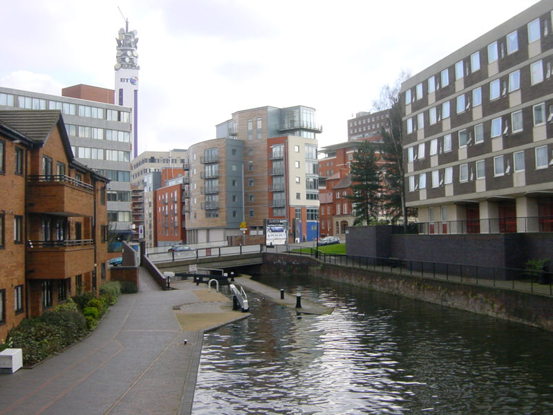
Birmingham
Another view from central Birmingham's vibrant canalscape - this time the 4th lock down the 13-lock Farmers Bridge flight, with the bridge carrying the A457 Summer Row from Birmingham to Smethwick.
See Google Aerial View of this location.
See LiveSearch Birds Eye View of this location.
Wednesday, 9 July 2008
Aynho Weir Lock
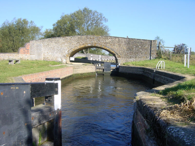
This is Aynho Weir Lock on the Southern Oxford Canal, south of Banbury. The lock is a curious shape, with narrow gates at each end, but with a chamber that widens out to around 20 feet, making it awkward for solo boaters with shorter boats, especially as there are no bollards to tie onto (or, at least, there weren't when the photo was taken).
The lock only has a fall of around 1 foot, but it feeds the 12 foot deep Somerton Lock, 3 miles downstream. So, the unusual shape is to allow extra water to be sent downstream each time the lock is used.The River Cherwell crosses the canal on a level just above Aynho Weir Lock, sometimes creating interesting currents.
See Google Aerial View of this location.
Monday, 7 July 2008
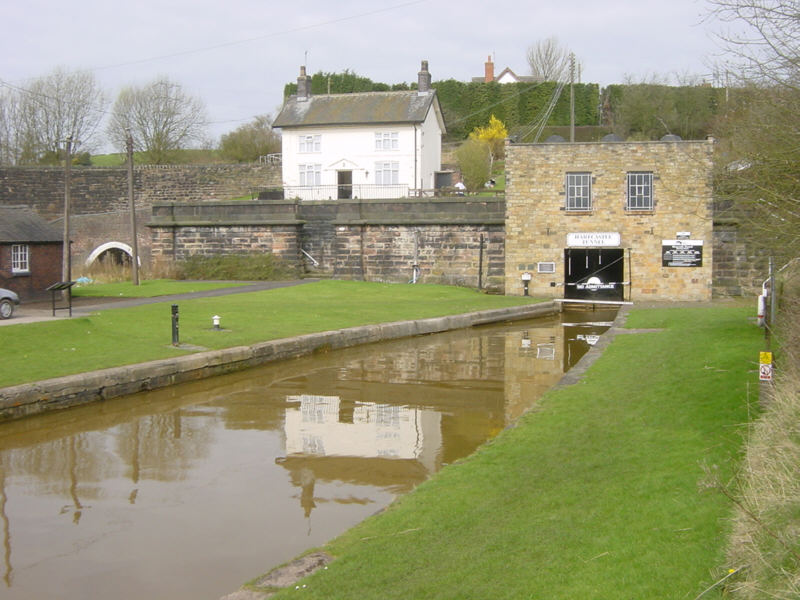
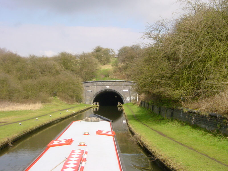
Harecastle
Another view of the southern portal of Harecastle Tunnel on the Trent and Mersey Canal in Staffordshire.
In the background on the left you can see the portal to Brindley's original 1777 tunnel, which is no longer navigable.
See Google Aerial View of this location.
See LiveSearch Birds Eye View of this location.
Saturday, 5 July 2008
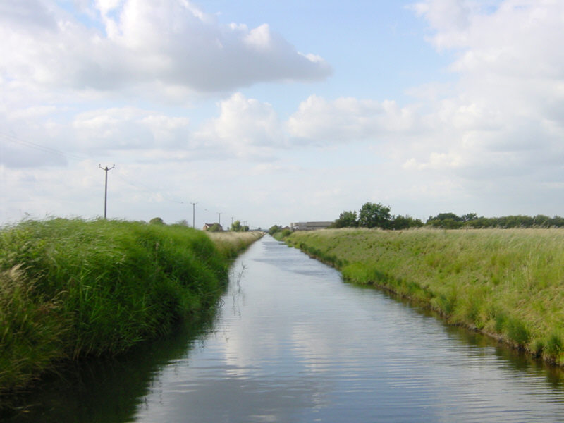
Witham Navigable Drains
A view along Newham Drain on the Witham Navigable Drains, near Boston in Lincolnshire.
The Witham Navigable Drains are a network of around 40 miles of channels of various widths, accessed by locking down from the River Witham at Anton's Gowt. The drains lead into Boston alongside Maud Foster's Windmill.
See Google Aerial View of this location.
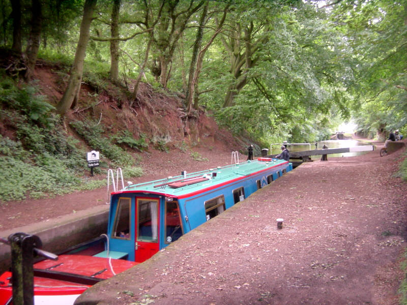
Thursday, 3 July 2008
Tyrley Locks
Just a mile south of the bridge at Market Drayton is the flight of five locks at Tyrley. The strikingly red soil of the cutting indicates red sandstone underlying the area.
Tyrley Castle once stood on a site between here and Market Drayton, now occupied by Tyrley Castle Farm. Above the locks is Tyrley Wharf with its collection of 1840s red brick buildings.
See Google Aerial View of this location.
Tuesday, 1 July 2008
Consall Forge
Consall Forge is a surprisingly remote place on the Caldon Canal in Staffordshire. It is many miles from the nearest road, by means of a narrow track. It does, however, have a station on the North Staffordshire Railway (Churnet Valley Railway).
The Black Lion Inn, seem behind the railway, is a must for boaters stopping here overnight on their way to Froghall.
See Google Aerial View of this location.
Sunday, 29 June 2008
Netherton Tunnel
The southern end of Netherton Tunnel near Dudley. This view is approaching the tunnel from nearby Windmill End. The tunnel is 2768 metres long (1.72 miles). It was opened in 1858, is wide enough for two narrowboats to pass and has towpaths down both sides so that two-way traffic could operate back in the days when boats were horse drawn.
See Google Aerial View of this location.
See LiveSearch Birds Eye View of this location.
Friday, 27 June 2008
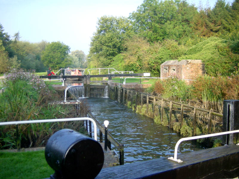
Garston Lock
Garston Lock, on the Kennet and Avon Canal near Theale, is another example of a Kennet turf-sided lock, although it was modified during restoration to improve safety.
The lock was built in the 1720s. A number of the locks on the Kennet navigation were originally of this sloping-sided design, since water consumption was less of a problem on a river than on a canal. Only two remain. (See also Monkey Marsh Lock.)
See Google Aerial View of this location.
Wednesday, 25 June 2008
Cropredy
Another view of picturesque Cropredy on the South Oxford Canal, this time from below the bridge and lock.
See Google Aerial View of this location.
Monday, 23 June 2008
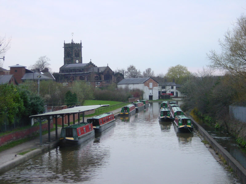
Middlewich
Middlewich is a busy location on the Trent and Mersey Canal. The Middlewich Branch from the Shropshire Union Canal arrives in the town from the west, so a visit to Middlewich forms part of many people's routes. There are two hire boat bases here and the town is a popular stop for boaters.
See Google Aerial View of this location.
Saturday, 21 June 2008
Bath
Just above the Widcombe flight of locks in Bath, the Kennet and Avon Canal passes through the middle of the Sydney Gardens. The gardens were Bath's first "park" and were visited frequently by Jane Austen.
They were created in 1795 and 15 years later, in 1810, the canal was constructed through the middle. Later still, in 1840, the Great Western Railway carved a parallel cutting through the gardens.
See Google Aerial View of this location.
See LiveSearch Birds Eye View of this location.
Friday, 20 June 2008
Froncysyllte
Froncysyllte is on the Llangollen Canal just on the south side of the famous Pontcysyllte Aqueduct. The canal passes through the edge of Froncysyllte village.
In the distance can be seen the lift bridge and footbridge just before the bend that takes the canal round to the aqueduct.
See Google Aerial View of this location.
Wednesday, 18 June 2008
Trent Lock
The River Trent at Trent Lock is a peaceful location on a sunny day, although the area can become exciting when the river is in flood.
This spot is a complicated waterway junction, with the River Trent leading upstream to the right towards Sawley and the Trent and Mersey Canal and ahead towards the weir marked by the red barrels. To the right of the weir, the white sign marks the entrance to the River Soar, leading to Leicester and the Grand Union Canal. To the left, in the foreground, the weir is bypassed by the Cranfleet Cut leading downstream towards Nottingham. Out of sight to the left is Trent Lock, which lets boats access the Erewash Canal.
See Google Aerial View of this location.
See LiveSearch Birds Eye View of this location.

